 http://atlas.nrcan.gc.ca/site/english/maps/topo/map
Wednesday, November 14, 2007
Canada topographic map
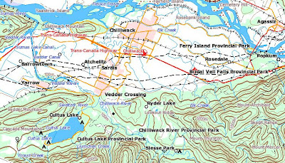
Topographical maps of Canada. The maps depict, in detail, ground relief (landforms and terrain), drainage (lakes and rivers), forest cover, administrative areas, populated areas, transportation routes and facilities (including roads and railways), and other constructed features. The maps show data from the 1:250 000 and 1:50 000 National Topographic Databases.
 http://atlas.nrcan.gc.ca/site/english/maps/topo/map
http://atlas.nrcan.gc.ca/site/english/maps/topo/map
Subscribe to:
Post Comments (Atom)
LinkWithin

No comments:
Post a Comment