 http://www.multimap.com/
Thursday, November 29, 2007
Sunday, November 25, 2007

Thursday, November 22, 2007

Tuesday, November 20, 2007
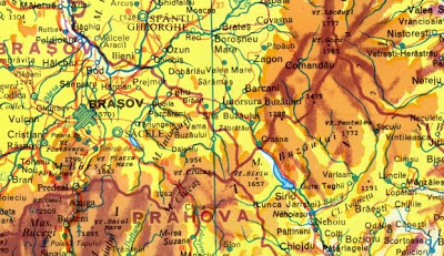
Romania relief map
Map of Romania with shaded relief in three different dimension (medium, large, huge).
 http://virtualromania.org/maps/
 http://virtualromania.org/maps/
Sunday, November 18, 2007

Friday, November 16, 2007

Wednesday, November 14, 2007
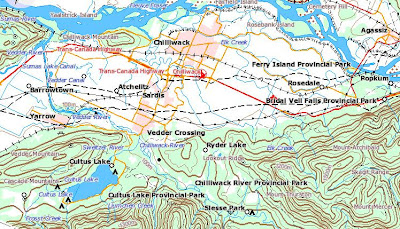
Canada topographic map
Topographical maps of Canada. The maps depict, in detail, ground relief (landforms and terrain), drainage (lakes and rivers), forest cover, administrative areas, populated areas, transportation routes and facilities (including roads and railways), and other constructed features. The maps show data from the 1:250 000 and 1:50 000 National Topographic Databases.
 http://atlas.nrcan.gc.ca/site/english/maps/topo/map
 http://atlas.nrcan.gc.ca/site/english/maps/topo/map
Tuesday, November 13, 2007
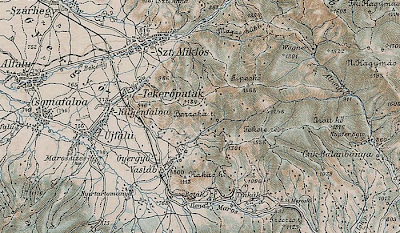
Central Europe old map
Old map of Central Europe from 3rd Military Mapping Survey of Austria-Hungary published at ~1910. The map contains 267 sheets with a total size of 935 Mb.
 http://lazarus.elte.hu/hun/digkonyv/topo/3felmeres.htm
http://lazarus.elte.hu/hun/digkonyv/topo/3felmeres.htm
Monday, November 12, 2007
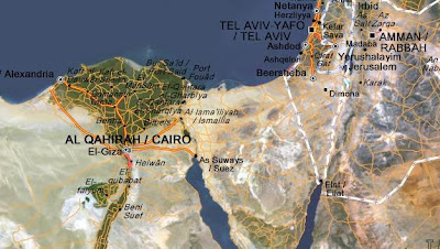
World map
Zoomable map of the world with satellite image.
 http://www.viamichelin.co.uk/viamichelin/gbr/dyn/controller/Maps
http://www.viamichelin.co.uk/viamichelin/gbr/dyn/controller/Maps
Sunday, November 11, 2007

Saturday, November 10, 2007

Subscribe to:
Posts (Atom)