 |
| Click to enlarge |
Geography, cartography, news on maps, online maps and route planners from around the world.
Showing posts with label Latin America. Show all posts
Showing posts with label Latin America. Show all posts
Monday, July 16, 2012
Central America Blank Map
Blank political map of Central America and northwestern South America with maritime borders.
Monday, May 7, 2012
Blank Map of Latin America
Friday, April 13, 2012
Tuesday, April 10, 2012
Wednesday, October 26, 2011
Latin America Map
Physical map of Latin America. The term Latin America is used loosely to refer to all the American countries south of the United States: used this way, it covers the whole of South America, Central America, Mexico, and the Caribbean. It is used in a strict sense to refer solely to the nations in those geographical regions where the Spanish and Portuguese languages predominate; this narrower definition excludes the countries and territories where English and other languages are spoken (Jamaica, Belize, Guyana, Suriname, Haiti, etc).
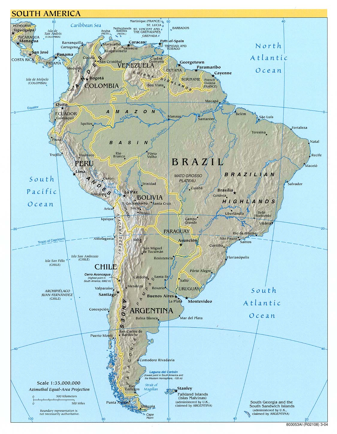
Zoomable physical map of South America.
 http://southamerica.zoom-maps.com/
 |
| Click to enlarge |
Zoomable physical map of South America.
 http://southamerica.zoom-maps.com/
Subscribe to:
Posts (Atom)


