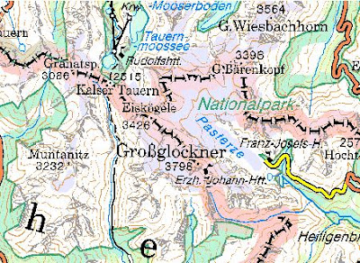
 http://www.austrianmap.at/
Sunday, December 30, 2007
Austria topographic map
Interactive topographic map of Austria with geographical name search option.
 http://www.austrianmap.at/
http://www.austrianmap.at/
Thursday, December 27, 2007
Xpeditions Atlas
Printable maps of the continents and countries with different level of detail. The maps can be downloaded in gif and pdf format.
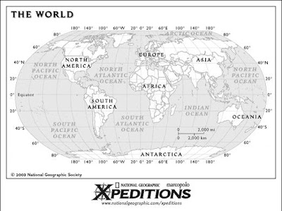 http://www.nationalgeographic.com/xpeditions/atlas/index.html
 http://www.nationalgeographic.com/xpeditions/atlas/index.html
Wednesday, December 26, 2007

Saturday, December 22, 2007

Wednesday, December 19, 2007

Tuesday, December 18, 2007


Monday, December 17, 2007
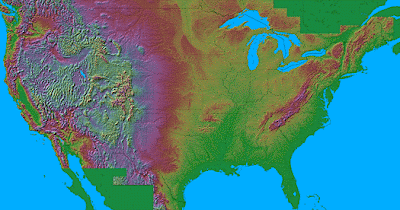
Relief maps of the United States
Shaded relief maps of the United States.
The maps use false-color 3-D shading to show changes of altitude, somewhat as if you were viewing the relief from a satellite. The maps are quite spectacular and very instructive; if you study a part of the country that you thought you knew intimately, you'll see all sorts of things you hadn't noticed before.
 http://birrell.org/andrew/reliefMaps/
Saturday, December 15, 2007

Thursday, December 13, 2007

Wednesday, December 12, 2007

Tuesday, December 11, 2007

Tuesday, December 4, 2007
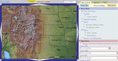
Map Maker
Online map maker with many different layers.
In the Map Maker, you can use more than 1,900 map layers to select, display, and print your own maps. You can locate any place in America and learn more about its features on your custom-made maps.
 http://nationalatlas.gov/natlas/Natlasstart.asp
In the Map Maker, you can use more than 1,900 map layers to select, display, and print your own maps. You can locate any place in America and learn more about its features on your custom-made maps.
 http://nationalatlas.gov/natlas/Natlasstart.asp
Subscribe to:
Posts (Atom)