 http://nojo.aquasoft.cz/FotoCaminoSantiago/Mista/MapSpain.jpg
Geography, cartography, news on maps, online maps and route planners from around the world.
Monday, December 14, 2009
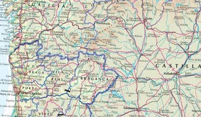
Spain and Portugal physical map
Physical map of Spain and Portugal with administrative divisions.
 http://nojo.aquasoft.cz/FotoCaminoSantiago/Mista/MapSpain.jpg
 http://nojo.aquasoft.cz/FotoCaminoSantiago/Mista/MapSpain.jpg
Thursday, December 10, 2009
Muscat and its surroundings
Road and physical map of Muscat (مسقط, Masqaṭ) and its surroundings.
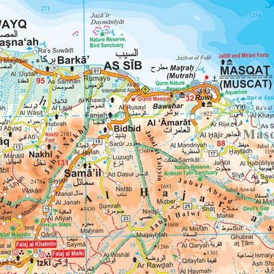
This is a part of Sultanate of Oman map by Gizi Map. Order printed version here.

This is a part of Sultanate of Oman map by Gizi Map. Order printed version here.
Sunday, December 6, 2009
Middle East road map
Labels:
Afghanistan,
Armenia,
Asia,
Azerbaijan,
Egypt,
Iran,
Iraq,
Israel,
Jordan,
Kuwait,
Lebanon,
Middle East,
Oman,
Pakistan,
Saudi Arabia,
Syria,
Turkey,
Turkmenistan,
United Arab Emirates,
Yemen
Thursday, December 3, 2009
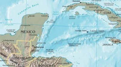
Central America physical map
Physical map of Central America.
 http://gonzoanthropology.files.wordpress.com/2009/03/central-america-map.jpg
 http://gonzoanthropology.files.wordpress.com/2009/03/central-america-map.jpg
Wednesday, December 2, 2009
Tuesday, December 1, 2009
Hong Kong and surroundings
Physical map of Hong Kong and nearby cities.
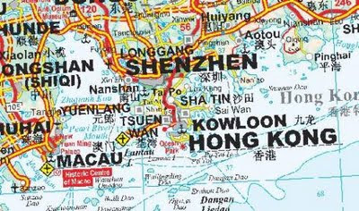 http://www.map.hu/galeria/20081129212912.jpg
Order printed version here.
 http://www.map.hu/galeria/20081129212912.jpg
Order printed version here.
Monday, November 30, 2009
Tuesday, November 10, 2009
Sunday, November 8, 2009
Italy roadmap in russian
Roadmap of Italy with russian names.
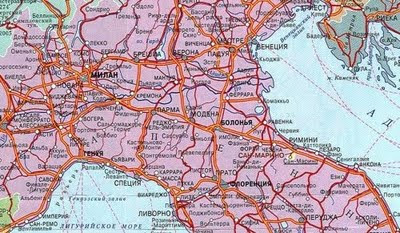 http://www.tour-systems.ru/italy/img/it_map/italy_map2.jpg
Zoomable road map of Italy.
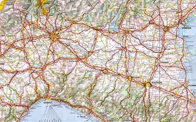 http://italia.zoom-maps.com/
 http://www.tour-systems.ru/italy/img/it_map/italy_map2.jpg
Zoomable road map of Italy.
 http://italia.zoom-maps.com/
Monday, November 2, 2009
Sunday, November 1, 2009
Mozambique map
High resolution map of Mozambique with roads,relief and street maps.
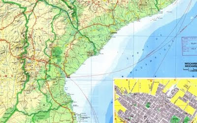 http://library.wur.nl/WebQuery/isric/18858
 http://library.wur.nl/WebQuery/isric/18858
Saturday, October 31, 2009
Friday, October 30, 2009
Yemen physical map
Physical map of Yemen with eastern and western part on separate pages.
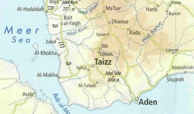 http://www.al-bab.com/dubaitours/map.htm
 http://www.al-bab.com/dubaitours/map.htm
Monday, October 26, 2009
Sunday, October 25, 2009
Saturday, October 24, 2009
Sudan roadmap
Relief and roadmap of Sudan in sheets.
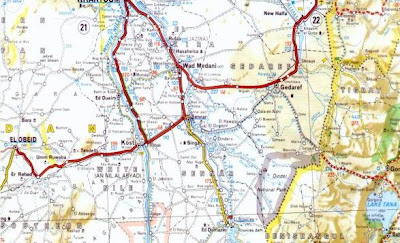 http://www.geocities.com/Athens/Atlantis/7088/Sudan_Maps/Sudan_Maps.htm
 http://www.geocities.com/Athens/Atlantis/7088/Sudan_Maps/Sudan_Maps.htm
Labels:
relief map,
roadmap,
Sudan
Friday, October 23, 2009
Tuesday, October 20, 2009
Wednesday, October 14, 2009
Tuesday, October 13, 2009
Iraq relief map
Map of Iraq with shaded relief.
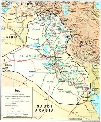 http://philbrgysocietyinnigeria.files.wordpress.com/2008/11/iraq_rel_2004.jpg
 http://philbrgysocietyinnigeria.files.wordpress.com/2008/11/iraq_rel_2004.jpg
Labels:
Iraq,
relief map
Sunday, October 11, 2009
Tanzania National Parks
Map of Tanzania with national parks.
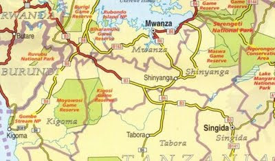 http://kilimanjaro.malinikaushik.com/KilimanjaroMapScans/TanzaniaNationalParks.JPG
 http://kilimanjaro.malinikaushik.com/KilimanjaroMapScans/TanzaniaNationalParks.JPG
Wednesday, October 7, 2009
D.R.Congo physical map
Physical map of Congo (Democratic Republic).
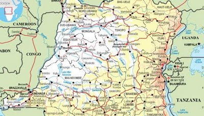 http://www.operations.mod.uk/mapping/CongoDemocraticRepublic.jpg
 http://www.operations.mod.uk/mapping/CongoDemocraticRepublic.jpg
Tuesday, October 6, 2009
Europe interactive map
Zoomable interactive map of Europe with relief and distances. Europe is the western fifth of the Eurasian landmass. In tems of area, Europe is the world's second smallest continent, being slightly larger than Oceania.
 |
| http://europe.zoom-maps.com/ |
Monday, October 5, 2009
Philippines map
Map of Philippines with administrative divisions.
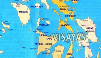 http://pioutsource.com/outsourcing/blog_article.php?id=167
 http://pioutsource.com/outsourcing/blog_article.php?id=167
Wednesday, September 30, 2009
Tuesday, September 29, 2009
Monday, September 28, 2009
Pakistan map
Map of Pakistan with main roads, cities and mountains.
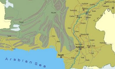 http://www.rolandziegler.de/Railtours/pakistan96/maps/pakistan-l.gif
 http://www.rolandziegler.de/Railtours/pakistan96/maps/pakistan-l.gif
Sunday, September 27, 2009
Ethiopia relief map
Map of Ethiopia with shaded relief.
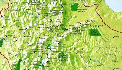 http://www.ethioembassy.org.uk/tourism/contents/Map%20of%20Ethiopia.htm
 http://www.ethioembassy.org.uk/tourism/contents/Map%20of%20Ethiopia.htm
Wednesday, September 16, 2009
Tuesday, September 15, 2009
Monday, September 14, 2009
Saturday, September 12, 2009
Papua New Guinea physical map
Physical map of Papua New Guinea.
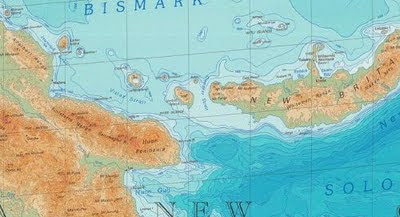 http://education.usgs.gov/common/resources/mapcatalog/images/international/east_asia7_11x14.jpg
 http://education.usgs.gov/common/resources/mapcatalog/images/international/east_asia7_11x14.jpg
Friday, September 11, 2009
Thursday, September 10, 2009
Wednesday, September 9, 2009
Tuesday, September 8, 2009
Monday, September 7, 2009
Southeast Asia travel map
Zoomable travel map of Southeast Asia with roads and shaded relief.
Countries: Myanmar, Laos, Vietnam, Thailand, Cambodia, Malaysia, Brunei, Taiwan, Indonesia, Philippines, East Timor. Map by Nelles Verlag.
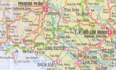 http://onlinemaps.byethost33.com/pages/asia/southeast-asia.php
Countries: Myanmar, Laos, Vietnam, Thailand, Cambodia, Malaysia, Brunei, Taiwan, Indonesia, Philippines, East Timor. Map by Nelles Verlag.
 http://onlinemaps.byethost33.com/pages/asia/southeast-asia.php
Sunday, September 6, 2009
Canada National Parks
Canada's National Parks and Terrestrial Ecozones Map
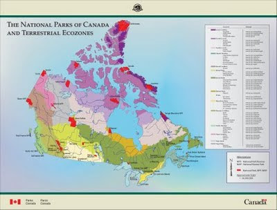 http://www.pc.gc.ca/apprendre-learn/prof/itm2-crp-trc/htm/ecozonesimage_e.asp
 http://www.pc.gc.ca/apprendre-learn/prof/itm2-crp-trc/htm/ecozonesimage_e.asp
Labels:
Canada
Thursday, September 3, 2009
Sunday, August 30, 2009
Saturday, August 29, 2009
United Kingdom relief map
Interactive relief map of United Kingdom with search option.
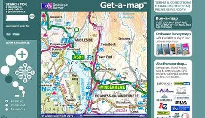 http://getamap.ordnancesurvey.co.uk/getamap/frames.htm
 http://getamap.ordnancesurvey.co.uk/getamap/frames.htm
Saturday, August 15, 2009
Sunday, August 2, 2009
Saturday, August 1, 2009
Friday, July 31, 2009
Kazakhstan physical map
Physical map of Kazakhstan in sheets.
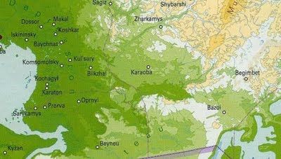
North Kazakhstan
West Kazakhstan
Central Kazakhstan
East Kazakhstan
South-East Kazakhstan
South Kazakhstan

North Kazakhstan
West Kazakhstan
Central Kazakhstan
East Kazakhstan
South-East Kazakhstan
South Kazakhstan
Wednesday, July 22, 2009
Chad political map
Administrative divisions of Chad.
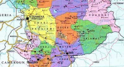 http://www.religiousintelligence.co.uk/maps/display_maps.php?CountryID=122
 http://www.religiousintelligence.co.uk/maps/display_maps.php?CountryID=122
Sunday, July 19, 2009
Wednesday, July 15, 2009
Subscribe to:
Comments (Atom)


