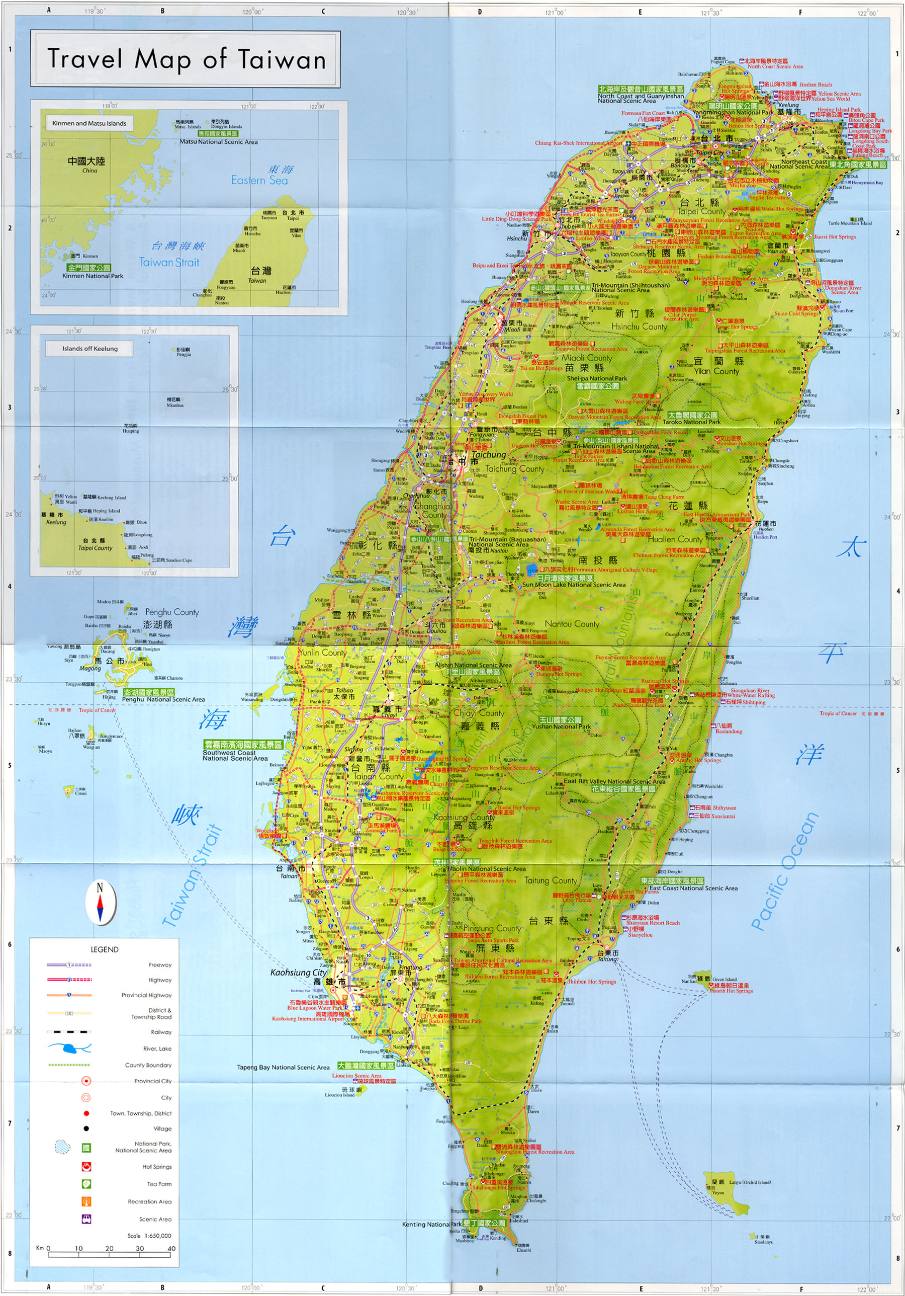
 http://eng.taiwan.net.tw/m1.aspx?sNo=0002306
Saturday, October 31, 2009
Friday, October 30, 2009
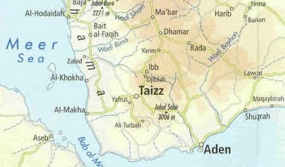
Yemen physical map
Physical map of Yemen with eastern and western part on separate pages.
 http://www.al-bab.com/dubaitours/map.htm
http://www.al-bab.com/dubaitours/map.htm
Monday, October 26, 2009

Sunday, October 25, 2009

Saturday, October 24, 2009
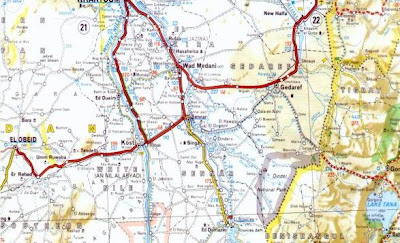
Sudan roadmap
Relief and roadmap of Sudan in sheets.
 http://www.geocities.com/Athens/Atlantis/7088/Sudan_Maps/Sudan_Maps.htm
http://www.geocities.com/Athens/Atlantis/7088/Sudan_Maps/Sudan_Maps.htm
Friday, October 23, 2009
Tuesday, October 20, 2009

Wednesday, October 14, 2009
Tuesday, October 13, 2009
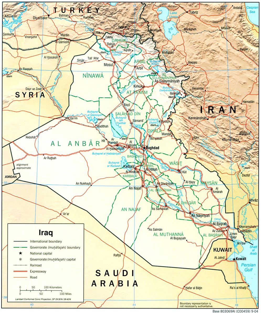
Iraq relief map
Map of Iraq with shaded relief.
 http://philbrgysocietyinnigeria.files.wordpress.com/2008/11/iraq_rel_2004.jpg
 http://philbrgysocietyinnigeria.files.wordpress.com/2008/11/iraq_rel_2004.jpg
Sunday, October 11, 2009
Tanzania National Parks
Map of Tanzania with national parks.
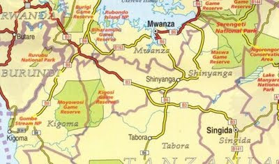 http://kilimanjaro.malinikaushik.com/KilimanjaroMapScans/TanzaniaNationalParks.JPG
 http://kilimanjaro.malinikaushik.com/KilimanjaroMapScans/TanzaniaNationalParks.JPG
Wednesday, October 7, 2009
D.R.Congo physical map
Physical map of Congo (Democratic Republic).
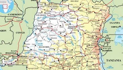 http://www.operations.mod.uk/mapping/CongoDemocraticRepublic.jpg
 http://www.operations.mod.uk/mapping/CongoDemocraticRepublic.jpg
Tuesday, October 6, 2009
Europe interactive map
Zoomable interactive map of Europe with relief and distances. Europe is the western fifth of the Eurasian landmass. In tems of area, Europe is the world's second smallest continent, being slightly larger than Oceania.
 |
| http://europe.zoom-maps.com/ |
Monday, October 5, 2009
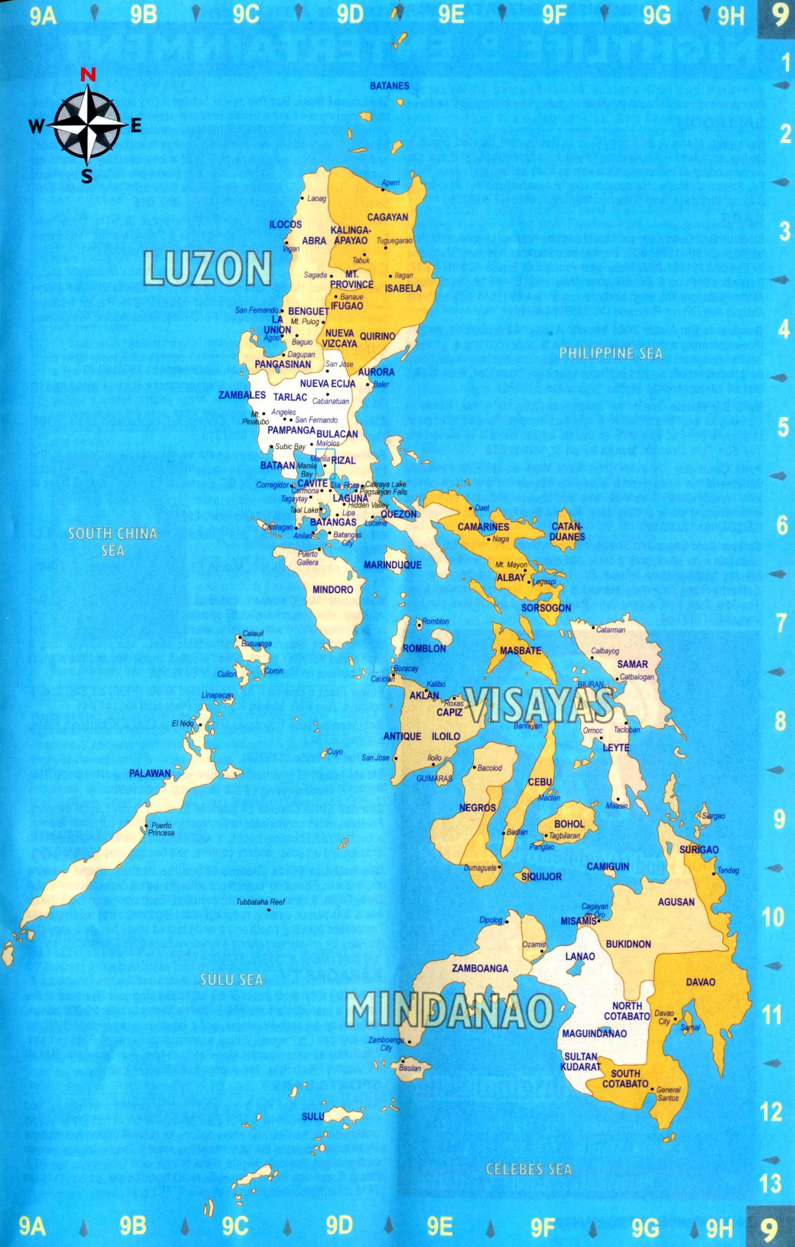
Philippines map
Map of Philippines with administrative divisions.
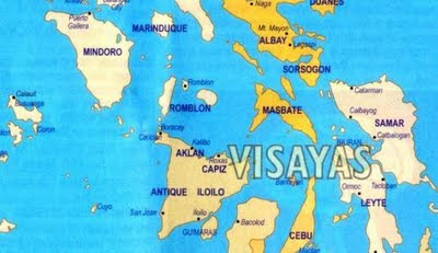 http://pioutsource.com/outsourcing/blog_article.php?id=167
 http://pioutsource.com/outsourcing/blog_article.php?id=167
Subscribe to:
Posts (Atom)