Showing posts with label South America. Show all posts

Tuesday, March 4, 2014

Saturday, July 13, 2013

Wednesday, May 1, 2013

South America Vegetation

South America vegetation map.


South America is one of the most biodiverse continents on earth. South America is home to many interesting and unique species of animals including the llama, anaconda, piranha, jaguar, vicuña, and tapir. The Amazon rainforests possess high biodiversity, containing a major proportion of the Earth's species. (wp)

Thursday, March 28, 2013

Amazon River Map

Physical map of Amazon river basin.

Click to enlarge
The Amazon River in South America is the second longest river in the world and by far the largest by waterflow with an average discharge greater than the next seven largest rivers combined (not including Madeira and Rio Negro, which are tributaries of the Amazon). The Amazon, which has the largest drainage basin in the world, about 7,050,000 square kilometres (2,720,000 sq mi), accounts for approximately one-fifth of the world's total river flow. (wp)
"Amazonrivermap" by Kmusser - Own work using Digital Chart of the World and GTOPO data.. Licensed under CC BY-SA 3.0 via Wikimedia Commons.

Tuesday, September 4, 2012

Untamed Americas Interactive Map

Meet 24 of the magnificent animals living untamed among the soaring mountains, burning deserts, tangled forests, and curvaceous coasts of the Americas, just beyond our own backyards. (National Geographic)

Monday, July 16, 2012

Central America Blank Map

Blank political map of Central America and northwestern South America with maritime borders.

Click to enlarge

Monday, May 7, 2012

Blank Map of Latin America

Blank map of Latin America. The term Latin America is used loosely to refer to all the American countries south of the United States.

Click to enlarge

Tuesday, April 10, 2012

Wednesday, March 28, 2012

Friday, March 2, 2012

Blank map of South America

Blank map of South America with country borders and major rivers. South America is a continent crossed by the equator, with most of its area in the Southern Hemisphere. South America is situated between the Pacific Ocean and the Atlantic Ocean. It became attached to North America only recently, geologically speaking, with the formation of the Isthmus of Panama.

Click to enlarge

Wednesday, October 26, 2011

Latin America Map

Physical map of Latin America. The term Latin America is used loosely to refer to all the American countries south of the United States: used this way, it covers the whole of South America, Central America, Mexico, and the Caribbean. It is used in a strict sense to refer solely to the nations in those geographical regions where the Spanish and Portuguese languages predominate; this narrower definition excludes the countries and territories where English and other languages are spoken (Jamaica, Belize, Guyana, Suriname, Haiti, etc).

Click to enlarge

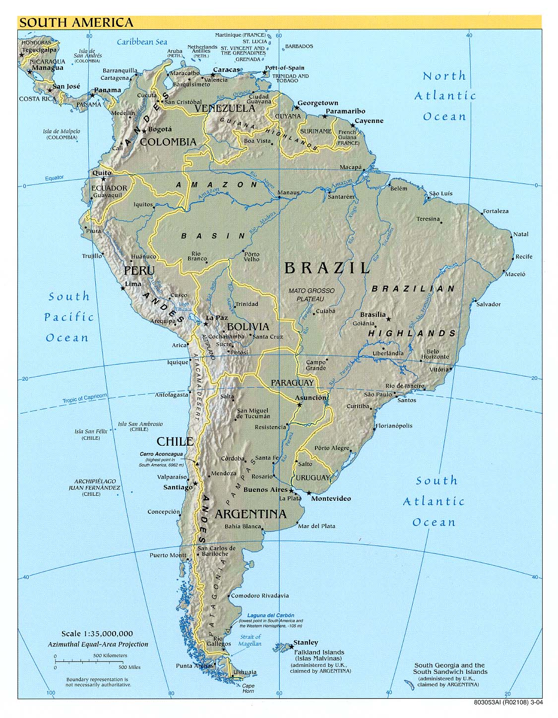
Zoomable physical map of South America.

http://southamerica.zoom-maps.com/