Online Maps
Geography, cartography, news on maps, online maps and route planners from around the world.
Showing posts with label
France
.
Show all posts
Showing posts with label
France
.
Show all posts
Saturday, February 8, 2014
French Colonial Empire, 1931
Colonial Empire of France in 1931.
Click to enlarge
Blue - French territories, Red - English territories
published by Fortune Magazine,
via
Saturday, July 6, 2013
How big is France?
Comparing France with other countries.
France and Central Europe
Read more »
Wednesday, January 23, 2013
Mountains in France
Map of France with mountains.
Click to enlarge
Géographie en images, 1949
Friday, August 3, 2012
Paris and its surroundings
Map of Paris
and its surroundings.
Click to enlarge
Thursday, February 23, 2012
France: Cities
Physical map of France with largest cities.
Click to enlarge
Monday, June 14, 2010
Alps travel map
Travel map of the Alps region.
http://alps.zoom-maps.com/
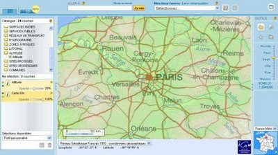
Sunday, November 23, 2008
France interactive map
Route planner and interactive map of France. Hidrographic, relief, satellite image, aerial view and other layers, search option.
http://www.geoportail.fr/visu2D.do?ter=metropole
Older Posts
Home
Subscribe to:
Posts (Atom)

 http://www.geoportail.fr/visu2D.do?ter=metropole


