Showing posts with label roadmap. Show all posts

Saturday, September 22, 2012

Alaska Highway Map

Map of the Alaska Highway.  
The Alaska Highway was constructed during World War II for the purpose of connecting the contiguous U.S. to Alaska through Canada. It begins at the junction with several Canadian highways in Dawson Creek, British Columbia and runs to Delta Junction, Alaska, via Whitehorse, Yukon. (Wikipedia)
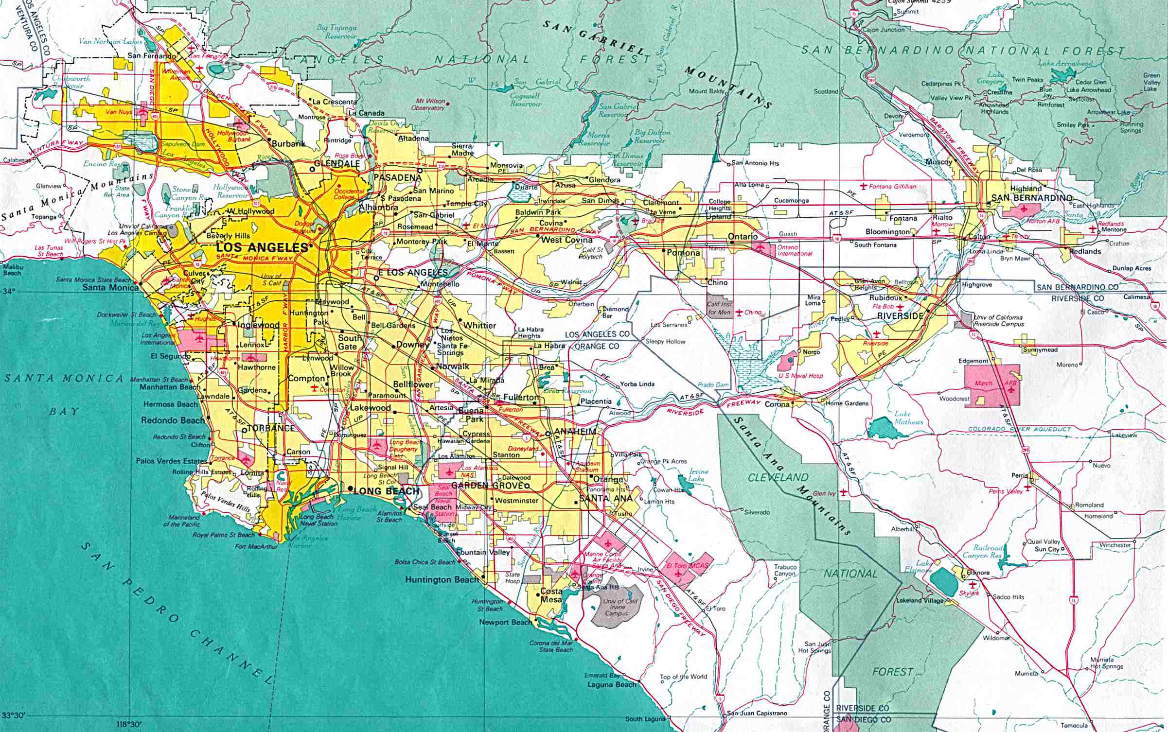
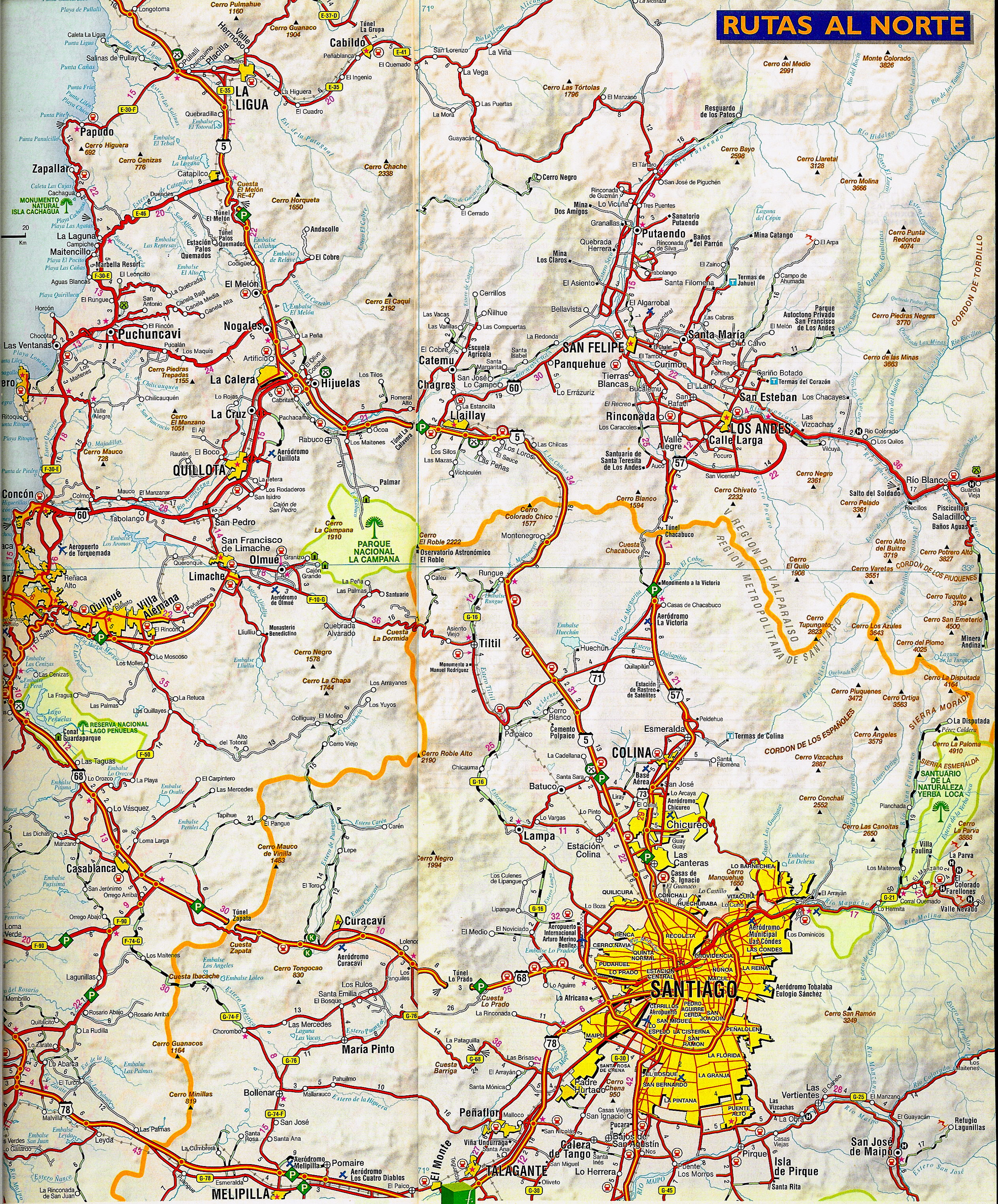
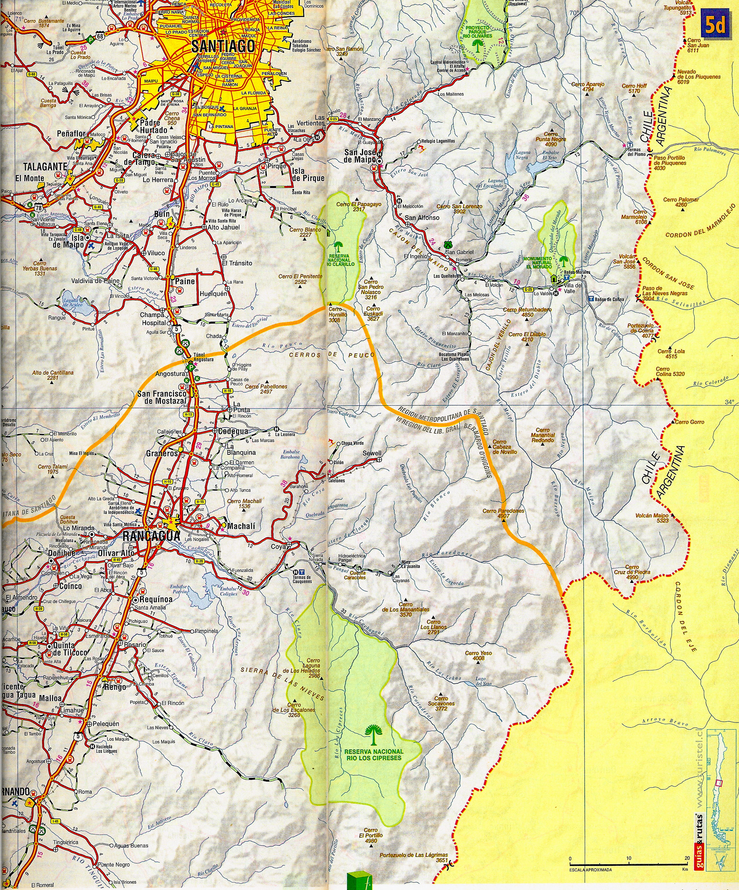
Click to enlarge

Friday, June 1, 2012

Central Europe Map

Political and road map of Central Europe.

Click to enlarge

Tuesday, April 3, 2012

England map with cities

Map of England with main roads and cities.
Click to enlarge

Monday, April 2, 2012

Chicago Area Map

Road map of Chicago neighborhoods.
Click to enlarge

Friday, March 30, 2012

Chicago City map

Road map of Chicago, IL, with road numbers.
chicago city map
Click to enlarge

Wednesday, March 28, 2012

Sunday, March 25, 2012

Singapore Road Map

Road map of Singapore with roads, railroads and expressways. The Republic of Singapore is an island city-state in Southeast Asia, at latitude 1°17'35"N longitude 103°51'20"E, situated on the southern tip of Malay Peninsula, south of the state of Johor of Peninsular Malaysia and north of the Indonesian islands of Riau.

Saturday, March 24, 2012

Map of Santiago, Chile

Map of Santiago and its surroundings with road numbers and distances.

Click to enlarge


Wednesday, August 4, 2010

Bulgaria road map

Interactive road map of Bulgaria.

National Parks and Monuments • Points of Interest • Tourist Attractions, Resorts and Facilities • Road Distances • Street map of Sofija, Plovdiv, Burgas and Varna • Detailed Scale of: 1:800,000

http://bulgaria.zoom-maps.com/

Sunday, April 4, 2010

Thursday, December 10, 2009

Muscat and its surroundings

Road and physical map of Muscat (مسقط, Masqaṭ) and its surroundings.


This is a part of Sultanate of Oman map by Gizi Map. Order printed version here.